Stable Block attached to Hursley House, IBM Hursley Laboratory
Introduction
The photograph on this page of Stable Block attached to Hursley House, IBM Hursley Laboratory by Peter Facey as part of the Geograph project.
The Geograph project started in 2005 with the aim of publishing, organising and preserving representative images for every square kilometre of Great Britain, Ireland and the Isle of Man.

There are currently over 7.5m images from over 14,400 individuals and you can help contribute to the project by visiting https://www.geograph.org.uk
Stable Block attached to Hursley House, IBM Hursley Laboratory
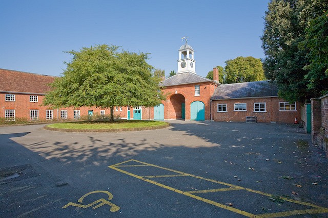
Image: © Peter Facey Taken: 18 Sep 2008
This building appears to be attached to the western end of Hursley House. It occupies three sides of a square, the other side being on the right of the photo. Probably originally a coach house and stables. It is now known as R and T Block. The keystone of the arch below the clock on the far side of the building has the date 1829 and letters which may possibly include WH. It is likely therefore that this block was built by William Heathcote who became the fifth baronet in 1825 ( http://www.hursley.hampshire.org.uk/history_of_hursley.htm#Heathcote ). See http://www-05.ibm.com/uk/locations/hursley.html Access by kind permission of IBM United Kingdom Limited.
Images are licensed for reuse under creativecommons.org/licenses/by-sa/2.0
Image Location
Latitude
51.026338
Longitude
-1.399935