Monifieth beach
Introduction
The photograph on this page of Monifieth beach by Val Vannet as part of the Geograph project.
The Geograph project started in 2005 with the aim of publishing, organising and preserving representative images for every square kilometre of Great Britain, Ireland and the Isle of Man.

There are currently over 7.5m images from over 14,400 individuals and you can help contribute to the project by visiting https://www.geograph.org.uk
Monifieth beach
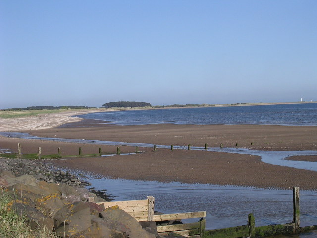
Image: © Val Vannet Taken: 13 May 2005
Severe erosion has reduced the beach at Monifieth from a dune system to a rock armoured shoreline in just 50 years. The view looks east to the mouth of the Buddon burn and beyond, the MOD land at Buddon Ness with the lighthouse in Image
Images are licensed for reuse under creativecommons.org/licenses/by-sa/2.0
Image Location


Leaflet Map data © OpenStreetMap
Latitude
56.481993
Longitude
-2.805299