Obelisk near Teddington Lock
Introduction
The photograph on this page of Obelisk near Teddington Lock by David Kemp as part of the Geograph project.
The Geograph project started in 2005 with the aim of publishing, organising and preserving representative images for every square kilometre of Great Britain, Ireland and the Isle of Man.

There are currently over 7.5m images from over 14,400 individuals and you can help contribute to the project by visiting https://www.geograph.org.uk
Obelisk near Teddington Lock
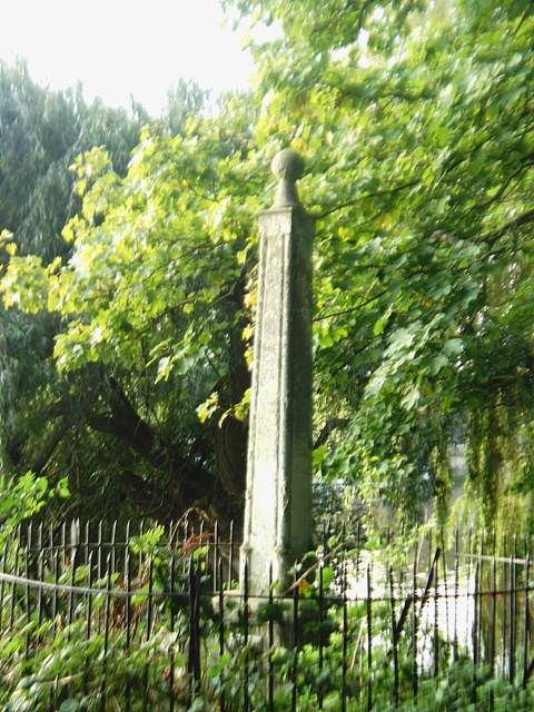
Image: © David Kemp Taken: 18 Sep 2008
Hidden in the trees and somewhat neglected, this obelisk is easy to miss. It marks the boundary between the sections of the Thames controlled by the Port of London Authority (downstream) and the Environment Agency (upstream) respectively. The river itself can be seen in the background.
Images are licensed for reuse under creativecommons.org/licenses/by-sa/2.0
Image Location
Latitude
51.433797
Longitude
-0.327173