Bonded warehouses at Dumbuck
Introduction
The photograph on this page of Bonded warehouses at Dumbuck by A-M-Jervis as part of the Geograph project.
The Geograph project started in 2005 with the aim of publishing, organising and preserving representative images for every square kilometre of Great Britain, Ireland and the Isle of Man.

There are currently over 7.5m images from over 14,400 individuals and you can help contribute to the project by visiting https://www.geograph.org.uk
Bonded warehouses at Dumbuck
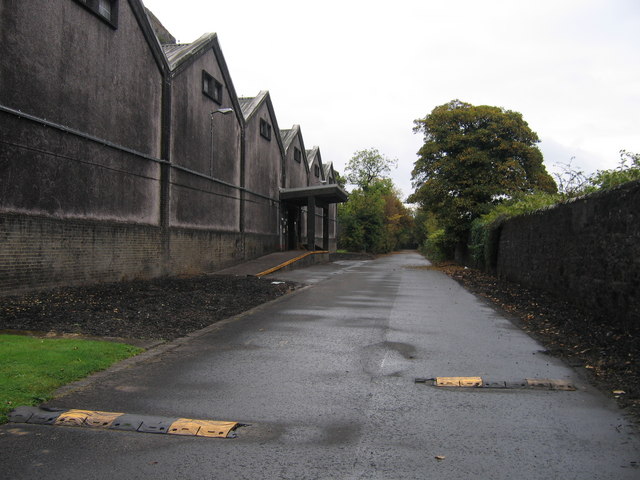
Image: © A-M-Jervis Taken: 13 Oct 2007
In the Dumbuck area, between Bowling and Dumbarton, there is a considerable acreage of bonded warehouses. The straight private road passing behind some of these was once the North British Railway route from Glasgow Queen Street to Dumbarton, Helensburgh and the West Highland line. In the 1960s, however, when British Railways was electrifying the route, it was the former Caledonian Railway line westward from Dumbuck through Dumbarton East station that was "wired" and the North British line that was closed. One wonders whether the short canopied platform was served by a siding when the railway was open.
Images are licensed for reuse under creativecommons.org/licenses/by-sa/2.0
Image Location
Latitude
55.938294
Longitude
-4.536581