
Bournemouth: postbox № BH2 29, West Hill Road
Introduction
The photograph on this page of Bournemouth: postbox № BH2 29, West Hill Road by Chris Downer as part of the Geograph project.
The Geograph project started in 2005 with the aim of publishing, organising and preserving representative images for every square kilometre of Great Britain, Ireland and the Isle of Man.

There are currently over 7.5m images from over 14,400 individuals and you can help contribute to the project by visiting https://www.geograph.org.uk
Bournemouth: postbox № BH2 29, West Hill Road
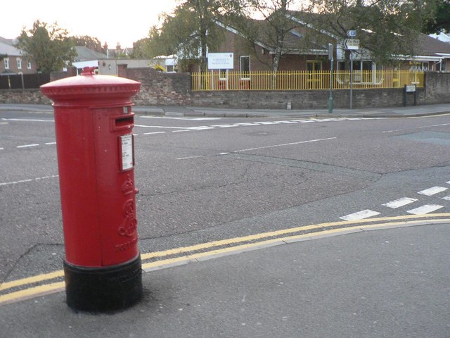
Image: © Chris Downer Taken: 11 Sep 2008
A large Edward VII-reign postbox outside Image In the distance, we see St. Michael's CE VC Primary School. (VC stands for Voluntary Controlled; this means that although it is a Church of England school, the Local Authority employs staff and decides admissions, as is the case with non-church schools. This allows it to act as a catchment area school for the Westbourne area, as there are no other schools in the vicinity. The converse is VA, Voluntary Aided, whereby the school governors appoint staff and make the admissions policy.)
Images are licensed for reuse under creativecommons.org/licenses/by-sa/2.0
Image Location

Latitude
50.718842
Longitude
-1.88705