Floods near Moira (1)
Introduction
The photograph on this page of Floods near Moira (1) by Albert Bridge as part of the Geograph project.
The Geograph project started in 2005 with the aim of publishing, organising and preserving representative images for every square kilometre of Great Britain, Ireland and the Isle of Man.

There are currently over 7.5m images from over 14,400 individuals and you can help contribute to the project by visiting https://www.geograph.org.uk
Floods near Moira (1)
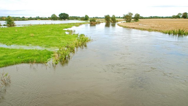
Image: © Albert Bridge Taken: 7 Sep 2008
See Image The heavy rain on 5/6 September caused the Lagan to break its banks in the flat countryside between Moira and the Maze. This is the view downstream, from the Newmill Bridge (the Clarehill Road), south east of Moira. Continue to Image For a seasonal comparison in water level see Image during a long dry spell.
Images are licensed for reuse under creativecommons.org/licenses/by-sa/2.0
Image Location


Leaflet Map data © OpenStreetMap
Latitude
54.472746
Longitude
-6.202489