St.Margaret's church, Roughton, Lincs.
Introduction
The photograph on this page of St.Margaret's church, Roughton, Lincs. by Richard Croft as part of the Geograph project.
The Geograph project started in 2005 with the aim of publishing, organising and preserving representative images for every square kilometre of Great Britain, Ireland and the Isle of Man.

There are currently over 7.5m images from over 14,400 individuals and you can help contribute to the project by visiting https://www.geograph.org.uk
St.Margaret's church, Roughton, Lincs.
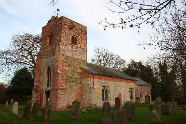
Image: © Richard Croft Taken: 24 Dec 2005
A fascinating archaeological puzzle and all the clues are on the outside ! There's just about everything from 12th century Norman to early 17th century brick. Obvious Transitional N & S blocked doorways in the wrong place, so the tower is later and further west, I spotted a re-set Norman capital in the NW corner of the nave wall.
Images are licensed for reuse under creativecommons.org/licenses/by-sa/2.0
Image Location


Leaflet Map data © OpenStreetMap
Latitude
53.164964
Longitude
-0.145144