Footbridge over Limehouse Cut
Introduction
The photograph on this page of Footbridge over Limehouse Cut by Dr Neil Clifton as part of the Geograph project.
The Geograph project started in 2005 with the aim of publishing, organising and preserving representative images for every square kilometre of Great Britain, Ireland and the Isle of Man.

There are currently over 7.5m images from over 14,400 individuals and you can help contribute to the project by visiting https://www.geograph.org.uk
Footbridge over Limehouse Cut
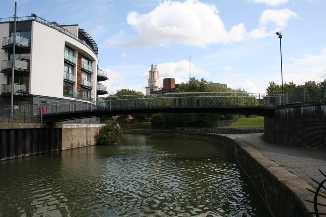
Image: © Dr Neil Clifton Taken: 3 Sep 2008
Should you decide to walk along the towpath of Limehouse Cut, starting from Limehouse Basin, you will first pass under two footbridges, of which this is the second. It lies at an interesting point, for as can be seen, Limehouse Cut has a bend in it here: until 1962, just beyond the footbridge, the Cut continued to the right, down a lock into the Thames. But in that year, the new link to Limehouse Basin (previously known as Regents Canal dock) was made and the exit to the Thames filled in. After that, boats for the Thames had to go via Limehouse Basin. Interestingly in Victorian times, Limehouse Cut had been linked to Regents Canal Dock, by a cut almost exactly where the 1962 cut was made! The link was thus filled in around 1862, and effectively re-opened 100 years later.
Images are licensed for reuse under creativecommons.org/licenses/by-sa/2.0
Image Location
Latitude
51.510523
Longitude
-0.032972