The Ninewells Doocot
Introduction
The photograph on this page of The Ninewells Doocot by Walter Baxter as part of the Geograph project.
The Geograph project started in 2005 with the aim of publishing, organising and preserving representative images for every square kilometre of Great Britain, Ireland and the Isle of Man.

There are currently over 7.5m images from over 14,400 individuals and you can help contribute to the project by visiting https://www.geograph.org.uk
The Ninewells Doocot
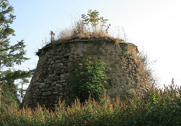
Image: © Walter Baxter Taken: 1 Sep 2008
This is the top part of a circular beehive type of rubble doocot that dates back to the 16th century. It stands in a garden adjacent to the parish church.
Images are licensed for reuse under creativecommons.org/licenses/by-sa/2.0
Image Location
Latitude
55.798463
Longitude
-2.208927