Rampart, Pen-y-corddyn Mawr
Introduction
The photograph on this page of Rampart, Pen-y-corddyn Mawr by Jonathan Wilkins as part of the Geograph project.
The Geograph project started in 2005 with the aim of publishing, organising and preserving representative images for every square kilometre of Great Britain, Ireland and the Isle of Man.

There are currently over 7.5m images from over 14,400 individuals and you can help contribute to the project by visiting https://www.geograph.org.uk
Rampart, Pen-y-corddyn Mawr
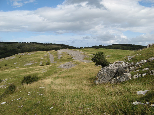
Image: © Jonathan Wilkins Taken: 2 Sep 2008
Only the northern side of the hillfort is without a natural defence, so a neat pair of ramparts run east to west and define the hilltop stronghold. As there is very little soil up here, the ramparts are built of broken limestone heaped up and looking today very like the lower scree slopes.
Images are licensed for reuse under creativecommons.org/licenses/by-sa/2.0
Image Location


Leaflet Map data © OpenStreetMap
Latitude
53.274614
Longitude
-3.628706