Footpath level crossing near Tullybreck
Introduction
The photograph on this page of Footpath level crossing near Tullybreck by A-M-Jervis as part of the Geograph project.
The Geograph project started in 2005 with the aim of publishing, organising and preserving representative images for every square kilometre of Great Britain, Ireland and the Isle of Man.

There are currently over 7.5m images from over 14,400 individuals and you can help contribute to the project by visiting https://www.geograph.org.uk
Footpath level crossing near Tullybreck
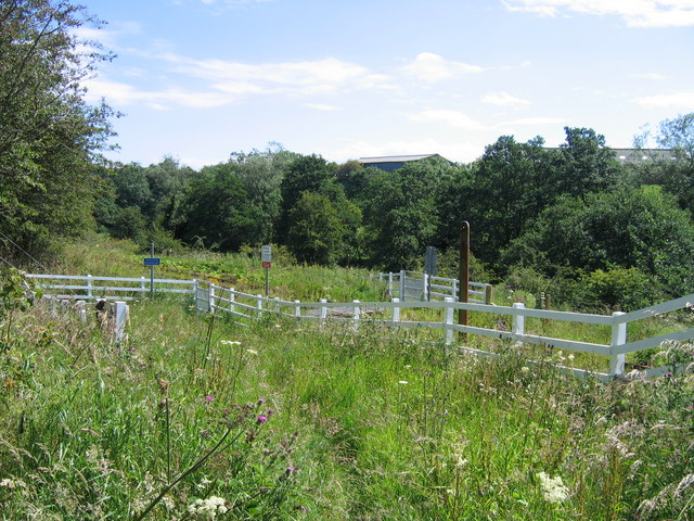
Image: © A-M-Jervis Taken: 23 Jul 2007
Another footpath crossing refurbished for the possible re-opening of part of the former Methil Power Station branch is close to Tullybreck farm, some of the buildings of which can be seen in the background. The blue sign at the bottom of the ramp reads "Cyclists dismount", but it would be a brave cyclist who tried to ride down this considerably overgrown path towards it.
Images are licensed for reuse under creativecommons.org/licenses/by-sa/2.0
Image Location
Latitude
56.175996
Longitude
-3.105406