Saint Mary's, Auchindoir
Introduction
The photograph on this page of Saint Mary's, Auchindoir by ronnie leask as part of the Geograph project.
The Geograph project started in 2005 with the aim of publishing, organising and preserving representative images for every square kilometre of Great Britain, Ireland and the Isle of Man.

There are currently over 7.5m images from over 14,400 individuals and you can help contribute to the project by visiting https://www.geograph.org.uk
Saint Mary's, Auchindoir
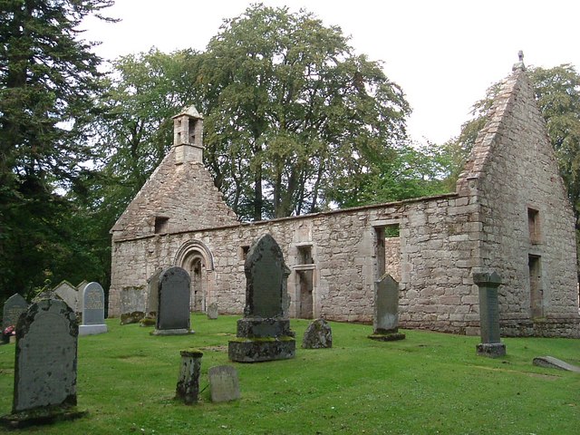
Image: © ronnie leask Taken: 4 Sep 2004
The belfry dates from 1664 but heraldic stones inside are dated 1557. There is a fine example of dog-toothing around the door. Altogether a most tranquil setting.
Images are licensed for reuse under creativecommons.org/licenses/by-sa/2.0
Image Location
Latitude
57.308078
Longitude
-2.868094