Kirkcaldy: Rabbit Braes
Introduction
The photograph on this page of Kirkcaldy: Rabbit Braes by Kevin O'Kane as part of the Geograph project.
The Geograph project started in 2005 with the aim of publishing, organising and preserving representative images for every square kilometre of Great Britain, Ireland and the Isle of Man.

There are currently over 7.5m images from over 14,400 individuals and you can help contribute to the project by visiting https://www.geograph.org.uk
Kirkcaldy: Rabbit Braes
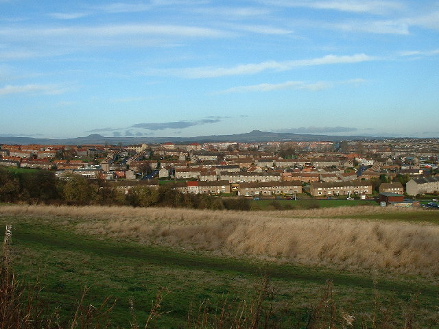
Image: © Kevin O'Kane Taken: 21 Dec 2005
from Bennochy Road, looking over the big field at Rabbit Braes, to Templehall and the Lomond Hills in the background. Kirkcaldy like this part of Fife is a series of hill ridges, the underlying rock is old red sandstone. The fields here are remnant of the Bogie Mains Farm.
Images are licensed for reuse under creativecommons.org/licenses/by-sa/2.0
Image Location
Latitude
56.1195
Longitude
-3.190158