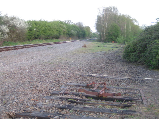
Former railway junction
Introduction
The photograph on this page of Former railway junction by Andy Gryce as part of the Geograph project.
The Geograph project started in 2005 with the aim of publishing, organising and preserving representative images for every square kilometre of Great Britain, Ireland and the Isle of Man.
There are currently over 7.5m images from over 14,400 individuals and you can help contribute to the project by visiting https://www.geograph.org.uk

Image: © Andy Gryce Taken: 21 Apr 2007
This photograph looking south-east shows the site of Grendon Underwood Junction on the Great Central Railway, see Image, which when it opened in 1899 was the last main line double track railway to be built. Here the main section of the railway that came from Sheffield and Nottingham in the north, that is behind the camera, split in two. On the line on the left, which is now a single track but still used by freight trains, the trains ran to Aylesbury and then onto Marylebone in London. However the line had to be shared with the Metropolitan Railway from Quainton Road station onwards, which is 4km further on. In the foreground are a few sleepers and part of a points mechanism, which is all that remains at this point of the alternative route to the London terminus via High Wycombe and which was not shared. Further ahead the track has not been dismantled and the line, though disused, runs south for some distance, see Image
Image Location


