Ferrydyke Bascule Bridge
Introduction
The photograph on this page of Ferrydyke Bascule Bridge by Lairich Rig as part of the Geograph project.
The Geograph project started in 2005 with the aim of publishing, organising and preserving representative images for every square kilometre of Great Britain, Ireland and the Isle of Man.

There are currently over 7.5m images from over 14,400 individuals and you can help contribute to the project by visiting https://www.geograph.org.uk
Ferrydyke Bascule Bridge
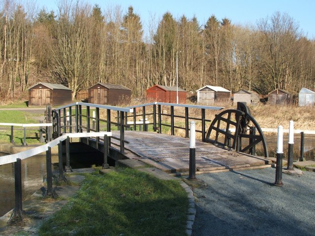
Image: © Lairich Rig Taken: 7 Feb 2007
This photo was taken from the cycle route that closely follows the Forth and Clyde Canal. The huts on the other side of the canal are in Portpatrick Road in Old Kilpatrick (compare Image). The term 'bascule' comes from a French word meaning a see-saw. The two sides of a bascule bridge are raised independently by people who use long lever handles to turn the cogs. The heavy bridge decks are counterweighted with underground weights in order to make this process easier. For a view across the bridge from the other side, see Image
Images are licensed for reuse under creativecommons.org/licenses/by-sa/2.0
Image Location
Latitude
55.925833
Longitude
-4.468691