River Ember: Summer Road footbridge
Introduction
The photograph on this page of River Ember: Summer Road footbridge by Nigel Cox as part of the Geograph project.
The Geograph project started in 2005 with the aim of publishing, organising and preserving representative images for every square kilometre of Great Britain, Ireland and the Isle of Man.

There are currently over 7.5m images from over 14,400 individuals and you can help contribute to the project by visiting https://www.geograph.org.uk
River Ember: Summer Road footbridge
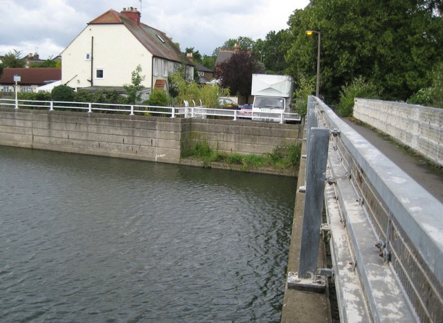
Image: © Nigel Cox Taken: 13 Aug 2008
It's extraordinary what old Ordnance Survey maps can tell us about the history of a location. Here we have the River Ember flowing in the concrete flood relief channel built in the 1970s. But go back to 1872 and the Ember would have looked much narrower, flowing and meandering like an ordinary river. However a footbridge crossing of the river already existed here at that time, linking East Molesey with Thames Ditton, and the track to and from the crossing followed the present-day alignment of Summer Road, even though there were no houses along it at that time. By 1898 a ford and a footbridge are shown on the mapping here, while most of the houses on the south side of Summer Road had been built. By 1920 most of the houses on the north side of Summer Road had been built along with Summer Gardens on the south side. Access across the river was still via the ford and footbridge. But by 1938 the ford is no longer marked on the map and the alignment of Molember Road and its first few houses are shown. Whether or not an actual road bridge was ever built across here I do not know.
Images are licensed for reuse under creativecommons.org/licenses/by-sa/2.0
Image Location
Latitude
51.397762
Longitude
-0.347895