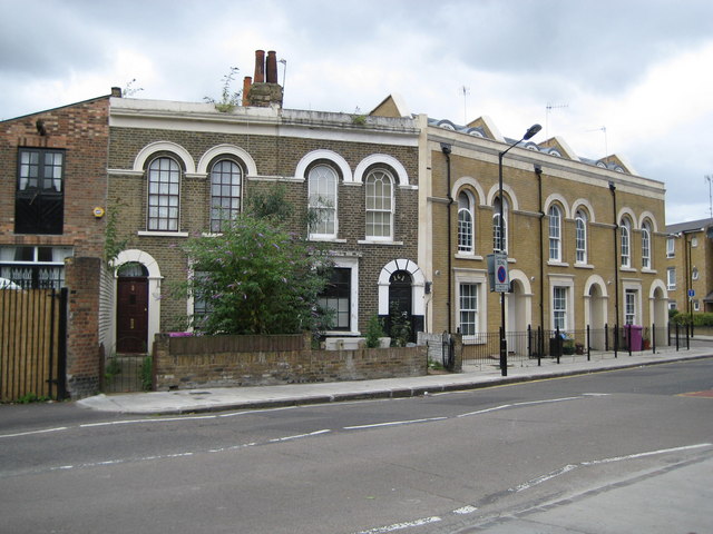
Bromley: St Leonard's Road
Introduction
The photograph on this page of Bromley: St Leonard's Road by Nigel Cox as part of the Geograph project.
The Geograph project started in 2005 with the aim of publishing, organising and preserving representative images for every square kilometre of Great Britain, Ireland and the Isle of Man.
There are currently over 7.5m images from over 14,400 individuals and you can help contribute to the project by visiting https://www.geograph.org.uk

Image: © Nigel Cox Taken: 19 Aug 2008
This image demonstrates the contrast between one of the few surviving blocks of the original Victorian housing in Poplar, and modern-day architects' attempts to replicate the style, meet the demands of the planning department of the London Borough of Tower Hamlets, and to provide houses suitable for modern living. The newer houses have the same design of archways, sash windows, and window lintels, while the roof parapet line has been retained at the same height, but note how the high ceilings in the rooms in the older houses must have been shortened in the newer properties as evidenced by the lower first floor windows, while partially hidden away behind the parapet of the newer houses are dormer windows indicating how the lower first floor has enabled the addition of a second floor in them. The old houses on the left are certainly shown on the Ordnance Survey map edition of 1869.

