Towers of Telegraph, St. Mary's
Introduction
The photograph on this page of Towers of Telegraph, St. Mary's by Bob Embleton as part of the Geograph project.
The Geograph project started in 2005 with the aim of publishing, organising and preserving representative images for every square kilometre of Great Britain, Ireland and the Isle of Man.

There are currently over 7.5m images from over 14,400 individuals and you can help contribute to the project by visiting https://www.geograph.org.uk
Towers of Telegraph, St. Mary's
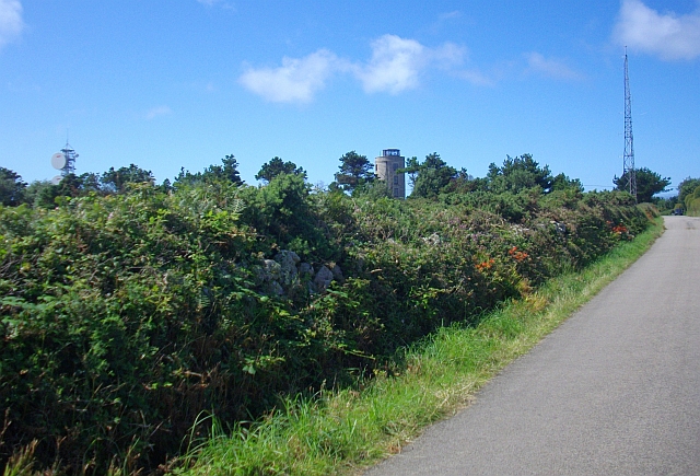
Image: © Bob Embleton Taken: 7 Aug 2008
Looking from Pungies Lane towards three towers close together in the hamlet known as Telegraph. The granite round tower in the centre was built on the highest point of the island as a gun and semaphore tower soon after 1805 and later adapted as a signal station. In 1898 Marconi received radio signals here from Portcurno 30 miles away. A more modern coastguard transmitter mast is on the right and an inter island microwave telecoms link can be seen on the left.
Images are licensed for reuse under creativecommons.org/licenses/by-sa/2.0
Image Location


Leaflet Map data © OpenStreetMap
Latitude
49.929177
Longitude
-6.303006