Dock Street Tunnel strengthening
Introduction
The photograph on this page of Dock Street Tunnel strengthening by A-M-Jervis as part of the Geograph project.
The Geograph project started in 2005 with the aim of publishing, organising and preserving representative images for every square kilometre of Great Britain, Ireland and the Isle of Man.

There are currently over 7.5m images from over 14,400 individuals and you can help contribute to the project by visiting https://www.geograph.org.uk
Dock Street Tunnel strengthening
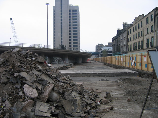
Image: © A-M-Jervis Taken: 21 Apr 2007
When the railway bridge across the "silv'ry Tay" was opened on 1 June 1878, there was little space between the city centre and the riverside docks through which to take the line. So it dropped steeply down into the new Tay Bridge station in a stone-walled cutting and immediately left through a cut-and-cover tunnel beneath Commercial Street and Dock Street before climbing steeply up to the Arbroath line at Camperdown Junction. In 2007, the increasing weight of road traffic necessitated the tunnel roof being strengthened and here the view is along the top of the newly concreted roof. The viaduct to the left is an approach to the Tay Road Bridge and the tall derelict building was Tayside House, the former headquarters of Tayside Regional Council.
Images are licensed for reuse under creativecommons.org/licenses/by-sa/2.0
Image Location


Leaflet Map data © OpenStreetMap
Latitude
56.459262
Longitude
-2.968712