Ordnance Survey Surveyor
Introduction
The photograph on this page of Ordnance Survey Surveyor by Alexander P Kapp as part of the Geograph project.
The Geograph project started in 2005 with the aim of publishing, organising and preserving representative images for every square kilometre of Great Britain, Ireland and the Isle of Man.

There are currently over 7.5m images from over 14,400 individuals and you can help contribute to the project by visiting https://www.geograph.org.uk
Ordnance Survey Surveyor
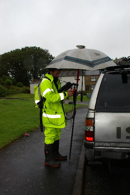
Image: © Alexander P Kapp Taken: 24 Aug 2005
I came across this Ordnance Survey surveyor improvising with an umbrella, trying to protect his delicate pen tablet computer from the ravages of a British summer in Hurst Green whilst he was doing a GPS controlled survey of the village
Images are licensed for reuse under creativecommons.org/licenses/by-sa/2.0
Image Location


Leaflet Map data © OpenStreetMap
Latitude
53.836397
Longitude
-2.478628