Parsonage Road, Eddington and its history
Introduction
The photograph on this page of Parsonage Road, Eddington and its history by D Gore as part of the Geograph project.
The Geograph project started in 2005 with the aim of publishing, organising and preserving representative images for every square kilometre of Great Britain, Ireland and the Isle of Man.

There are currently over 7.5m images from over 14,400 individuals and you can help contribute to the project by visiting https://www.geograph.org.uk
Parsonage Road, Eddington and its history
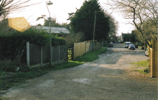
Image: © D Gore Taken: Unknown
This is looking east along the road which is still little more than the farm track it was a century ago when the land around was part of Parsonage Farm. That was before Herne Bay was built and when the farm consisted of a patchwork of fields between the old Herne village Image and the sea shore. Back then, the great Parsonage Farmhouse and its buildings stood immediately to the right of the picture beside this road/track which leads, as it still does today, to one of the farm's surviving fields Image See Gallery at: http://www.geograph.org.uk/gallery/trail_of_a_kentish_farming_family_9094 (background family story http://books.google.com/books?id=hrpS_YQ9FoAC&printsec=frontcover&dq=On+Kentish+Chalk )
Images are licensed for reuse under creativecommons.org/licenses/by-sa/2.0
Image Location
Latitude
51.36282
Longitude
1.133554