Down into Adpar
Introduction
The photograph on this page of Down into Adpar by Natasha Ceridwen de Chroustchoff as part of the Geograph project.
The Geograph project started in 2005 with the aim of publishing, organising and preserving representative images for every square kilometre of Great Britain, Ireland and the Isle of Man.

There are currently over 7.5m images from over 14,400 individuals and you can help contribute to the project by visiting https://www.geograph.org.uk
Down into Adpar
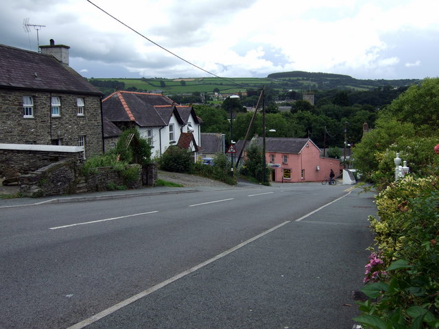
Image: © Natasha Ceridwen de Chroustchoff Taken: 12 Aug 2008
The road from the north dips down into the settlement of Adpar which is contiguous, via the bridge over the Teifi, with Newcastle Emlyn whose church tower can be seen in the distance here. Adpar used to be a borough in its own right. It has been suggested that the name derives from At-pawr (At-Pori) - meaning a good 'second crop' for grazing in the rich Teifi valley pasture lands. When English settlers arrived in the area Atpawr became known as Atpar and over the years changed yet again to Adpar. The original Welsh name was Trehedyn (seed place?)
Images are licensed for reuse under creativecommons.org/licenses/by-sa/2.0
Image Location
Latitude
52.041906
Longitude
-4.46659