"Fifteen Acres" - A remnant of Parsonage Farm
Introduction
The photograph on this page of "Fifteen Acres" - A remnant of Parsonage Farm by D Gore as part of the Geograph project.
The Geograph project started in 2005 with the aim of publishing, organising and preserving representative images for every square kilometre of Great Britain, Ireland and the Isle of Man.

There are currently over 7.5m images from over 14,400 individuals and you can help contribute to the project by visiting https://www.geograph.org.uk
"Fifteen Acres" - A remnant of Parsonage Farm
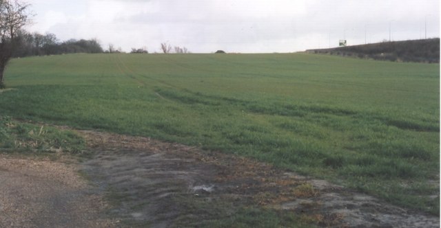
Image: © D Gore Taken: Unknown
View from the east end of Parsonage Road. This land was part of "Fifteen Acres", one of the few fields of Parsonage Farm that has survived the expansion of the new town of Herne Bay. On the 1840 Tythe Map Parsonage Farm consisted of a patchwork of fields spread between the old village of Herne Image almost down to the sea shore, then amounting to 165 acres. By the end of the 19th century the farm had been squeezed down to a few fields of cattle supplying 'The Creameries' in the town Image and by 1914 Parsonage Farm was virtually no more. See the Gallery at: http://www.geograph.org.uk/gallery/trail_of_a_kentish_farming_family_9094 (background family story http://books.google.com/books?id=hrpS_YQ9FoAC&printsec=frontcover&dq=On+Kentish+Chalk )
Images are licensed for reuse under creativecommons.org/licenses/by-sa/2.0
Image Location
Latitude
51.362903
Longitude
1.137151