Gallions Reach WW2 defences
Introduction
The photograph on this page of Gallions Reach WW2 defences by Julieanne Savage as part of the Geograph project.
The Geograph project started in 2005 with the aim of publishing, organising and preserving representative images for every square kilometre of Great Britain, Ireland and the Isle of Man.

There are currently over 7.5m images from over 14,400 individuals and you can help contribute to the project by visiting https://www.geograph.org.uk
Gallions Reach WW2 defences
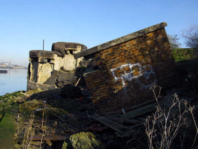
Image: © Julieanne Savage Taken: 10 Feb 2008
Two unusual WW2 defences overlooking Gallions Reach are slowly sliding down towards the river. Next to each other on the banks of the Thames are these variants. The pillbox behind is double-level with steps inside. It is covered in pitch. The pillbox in the foreground is a thin-walled brick variant, presumably a machine-gun emplacement. The area is littered with rubbish and debris including anti-tank concrete and rusting poles. Both defences are in poor condition and badly vandalised. I had to walk a long way to find them and clamber down a very slippery river-bank to investigate these. Both appear to be unlisted by 'Defence of Britain'. If you have any more information about them, please email me. I have visited many pillboxes and never seen ones like this.
Images are licensed for reuse under creativecommons.org/licenses/by-sa/2.0
Image Location
Latitude
51.50253
Longitude
0.086134