Stalisfield Church ? guarded by bloodhounds
Introduction
The photograph on this page of Stalisfield Church ? guarded by bloodhounds by D Gore as part of the Geograph project.
The Geograph project started in 2005 with the aim of publishing, organising and preserving representative images for every square kilometre of Great Britain, Ireland and the Isle of Man.

There are currently over 7.5m images from over 14,400 individuals and you can help contribute to the project by visiting https://www.geograph.org.uk
Stalisfield Church ? guarded by bloodhounds
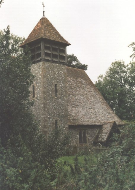
Image: © D Gore Taken: Unknown
The little church of Stalisfield is tucked away in the trees up on the North Downs alongside old farm building – used as kennels for a pack of bloodhounds when I visited. The church is distant from its main community, Stalisfield Green Image, a mile away by footpath but further by road. The church registers go back to 1699. Indexed list of memorials and grave inscriptions as at 1920 http://www.kentarchaeology.org.uk/Research/Libr/MIs/MIsStalisfield/MIsStalisfield.htm . Village information http://www.faversham.org/pages/standard.aspx?i_PageID=1187 . See also Image and Gallery at: http://www.geograph.org.uk/gallery/trail_of_a_kentish_farming_family_9094 (background family story http://books.google.com/books?id=hrpS_YQ9FoAC&printsec=frontcover&dq=On+Kentish+Chalk )
Images are licensed for reuse under creativecommons.org/licenses/by-sa/2.0
Image Location
Latitude
51.236929
Longitude
0.817507