Woodside Crescent, Sidcup, Kent
Introduction
The photograph on this page of Woodside Crescent, Sidcup, Kent by Roger D Kidd as part of the Geograph project.
The Geograph project started in 2005 with the aim of publishing, organising and preserving representative images for every square kilometre of Great Britain, Ireland and the Isle of Man.

There are currently over 7.5m images from over 14,400 individuals and you can help contribute to the project by visiting https://www.geograph.org.uk
Woodside Crescent, Sidcup, Kent
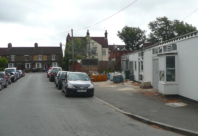
Image: © Roger D Kidd Taken: 3 Aug 2008
In the corner of this small line of "units", in the 1940s (maybe earlier) and through at least into the 1960s, was the "Tuck Shop". Juniors, at the school (fifty yards to the right at the end of the street) having asked permission of the dinner ladies, were allowed to come round at lunchtime for our black-jacks, sherbet dips, penny chews, bootlaces, aniseed balls, gobstoppers, chewing gum (discouraged), lemonade powder, liquorice (lickerish!) wood, shrimps etc. Update 2020. They've all been demolished and two houses built, but that same featheredge fence remains! See Streetview or https://i.imgur.com/oYOPt7W.jpg
Images are licensed for reuse under creativecommons.org/licenses/by-sa/2.0
Image Location
Latitude
51.431408
Longitude
0.090518