River Rom in Romford
Introduction
The photograph on this page of River Rom in Romford by Nigel Cox as part of the Geograph project.
The Geograph project started in 2005 with the aim of publishing, organising and preserving representative images for every square kilometre of Great Britain, Ireland and the Isle of Man.

There are currently over 7.5m images from over 14,400 individuals and you can help contribute to the project by visiting https://www.geograph.org.uk
River Rom in Romford
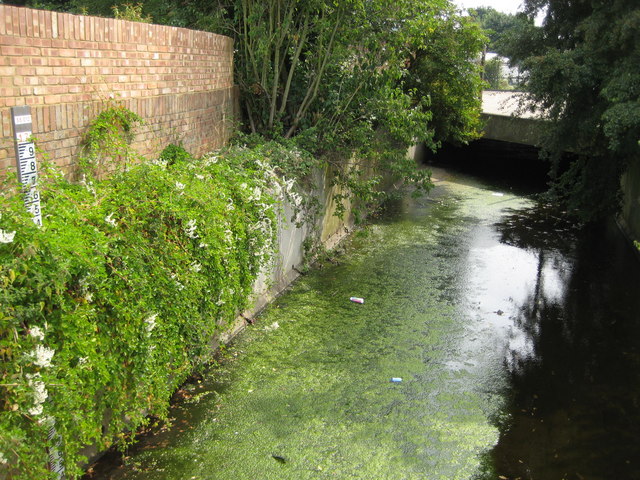
Image: © Nigel Cox Taken: 27 Jul 2008
An algal growth has formed a scummy layer on top of the river in this reach just downstream of the Cedar Road culvert and soon attracts litter. On the left is a water level gaugeboard. Each black and white bar on the board is one centimetre wide, and the top of the topmost black bar is 17 metres above sea level.
Images are licensed for reuse under creativecommons.org/licenses/by-sa/2.0
Image Location
Latitude
51.583341
Longitude
0.172256