Building with Staffordshire knot
Introduction
The photograph on this page of Building with Staffordshire knot by Derek Bennett as part of the Geograph project.
The Geograph project started in 2005 with the aim of publishing, organising and preserving representative images for every square kilometre of Great Britain, Ireland and the Isle of Man.

There are currently over 7.5m images from over 14,400 individuals and you can help contribute to the project by visiting https://www.geograph.org.uk
Building with Staffordshire knot
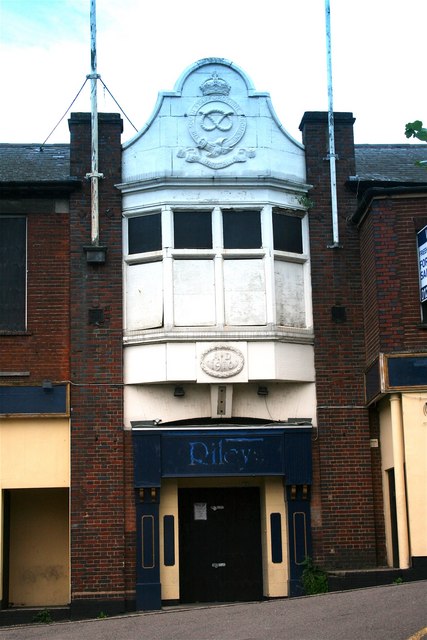
Image: © Derek Bennett Taken: 3 Aug 2008
This unused building, which proudly carries the Staffordshire knot on its facade, was obviously built in the days when Walsall was part of Staffordshire, not the artificial and meaningless construct created in the 1970's now called the 'West Midlands'. Mark Powell adds, "Former drill hall of the 5th battalion South Staffordshire Regiment Territorial Army. Later a night club called the fifth."
Images are licensed for reuse under creativecommons.org/licenses/by-sa/2.0
Image Location
Latitude
52.586014
Longitude
-1.977522