79 Eastgate Street, Stafford
Introduction
The photograph on this page of 79 Eastgate Street, Stafford by Simon Huguet as part of the Geograph project.
The Geograph project started in 2005 with the aim of publishing, organising and preserving representative images for every square kilometre of Great Britain, Ireland and the Isle of Man.

There are currently over 7.5m images from over 14,400 individuals and you can help contribute to the project by visiting https://www.geograph.org.uk
79 Eastgate Street, Stafford
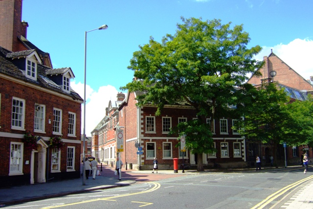
Image: © Simon Huguet Taken: 2 Aug 2008
Now largely screened by trees Eastgate House is a 17th century Jacobean house that used to house the town's MP and Chief Constable. It is now the Town's Register Office. The building to its left is the County Council Staff Club.
Images are licensed for reuse under creativecommons.org/licenses/by-sa/2.0
Image Location
Latitude
52.806835
Longitude
-2.115072