Preston Hall, Cupar
Introduction
The photograph on this page of Preston Hall, Cupar by Jim Bain as part of the Geograph project.
The Geograph project started in 2005 with the aim of publishing, organising and preserving representative images for every square kilometre of Great Britain, Ireland and the Isle of Man.

There are currently over 7.5m images from over 14,400 individuals and you can help contribute to the project by visiting https://www.geograph.org.uk
Preston Hall, Cupar
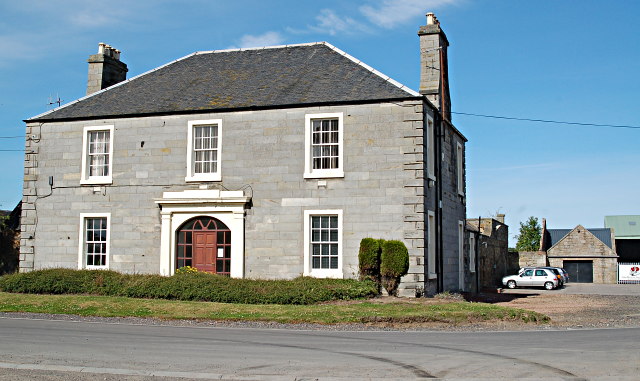
Image: © Jim Bain Taken: 21 Jul 2008
080721.01 Preston Hall, Cupar West face of the hall which now lies deep in the industrial estate named after it. Which grid is in? It's one of those buildings that straddle the line but think the most of it is in this square.
Images are licensed for reuse under creativecommons.org/licenses/by-sa/2.0
Image Location
Latitude
56.323664
Longitude
-2.982737