Junction of the Erewash and Derby and Sandiacre Canals
Introduction
The photograph on this page of Junction of the Erewash and Derby and Sandiacre Canals by Oxymoron as part of the Geograph project.
The Geograph project started in 2005 with the aim of publishing, organising and preserving representative images for every square kilometre of Great Britain, Ireland and the Isle of Man.

There are currently over 7.5m images from over 14,400 individuals and you can help contribute to the project by visiting https://www.geograph.org.uk
Junction of the Erewash and Derby and Sandiacre Canals
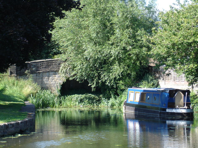
Image: © Oxymoron Taken: 21 Jul 2008
The bridge, partially obscured by summer foliage, represents the point at which the old Derby and Sandiacre joined the Erewash canal. The bridge is redundant, as the canal bed immediately behind it has been filled in.
Images are licensed for reuse under creativecommons.org/licenses/by-sa/2.0
Image Location
Latitude
52.917199
Longitude
-1.285059