Ferring Rife
Introduction
The photograph on this page of Ferring Rife by Simon Carey as part of the Geograph project.
The Geograph project started in 2005 with the aim of publishing, organising and preserving representative images for every square kilometre of Great Britain, Ireland and the Isle of Man.

There are currently over 7.5m images from over 14,400 individuals and you can help contribute to the project by visiting https://www.geograph.org.uk
Ferring Rife
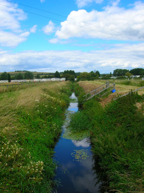
Image: © Simon Carey Taken: 20 Jul 2008
Rife is a local name for a small watercourse and is prevalent in the coastal plain area between here and Chichester Harbour. The stream rises from near Goring and enters the sea on the western side of Ferring. Much of it has been straightened and embanked over the centuries. To the left is Onslow Caravan Park whilst Highdown Hill provides the backdrop.
Images are licensed for reuse under creativecommons.org/licenses/by-sa/2.0
Image Location
Latitude
50.815137
Longitude
-0.454562