
Surface remains of Tankerville Lead Mine
Introduction
The photograph on this page of Surface remains of Tankerville Lead Mine by Richard Law as part of the Geograph project.
The Geograph project started in 2005 with the aim of publishing, organising and preserving representative images for every square kilometre of Great Britain, Ireland and the Isle of Man.

There are currently over 7.5m images from over 14,400 individuals and you can help contribute to the project by visiting https://www.geograph.org.uk
Surface remains of Tankerville Lead Mine
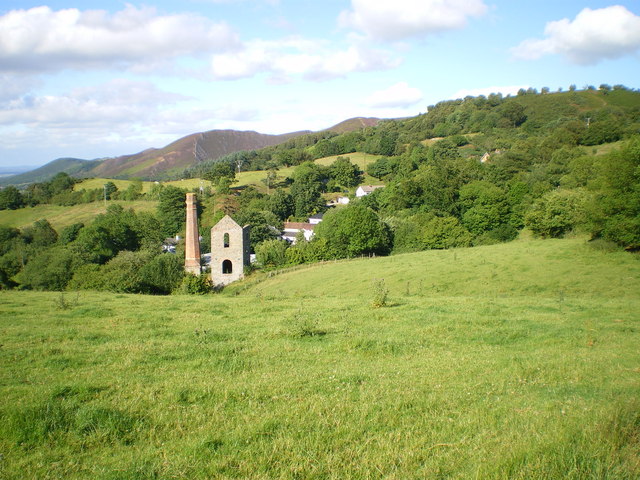
Image: © Richard Law Taken: 19 Jul 2008
The engine house and chimney of the old Tankerville Lead Mine. The remaining buildings were rescued from dereliction by the Shropshire Mines Trust charity in the late 1990s. The mine was worked most intensively for a period between 1860 to 1884, then less busily until 1894 when it finally closed as a deep lead mine, having become uneconomic. Barytes extraction continued in the upper parts of the shafts and tunnels above flood level, but that too eventually became worked out, and the whole site closed in the mid 1920s. During that time, it produced 13,000 tons of lead, 380 tons of barytes, 94 tons of zinc and 23,500 ounces of silver. The Engine House pictured here contained a 40" Cornish engine, made in Hayle. The hillspur in the background leads up onto the Stiperstones ridge, above the village of Stiperstones.
Images are licensed for reuse under creativecommons.org/licenses/by-sa/2.0
Image Location

Latitude
52.589367
Longitude
-2.953511