Chapel at Cippyn
Introduction
The photograph on this page of Chapel at Cippyn by Natasha Ceridwen de Chroustchoff as part of the Geograph project.
The Geograph project started in 2005 with the aim of publishing, organising and preserving representative images for every square kilometre of Great Britain, Ireland and the Isle of Man.

There are currently over 7.5m images from over 14,400 individuals and you can help contribute to the project by visiting https://www.geograph.org.uk
Chapel at Cippyn
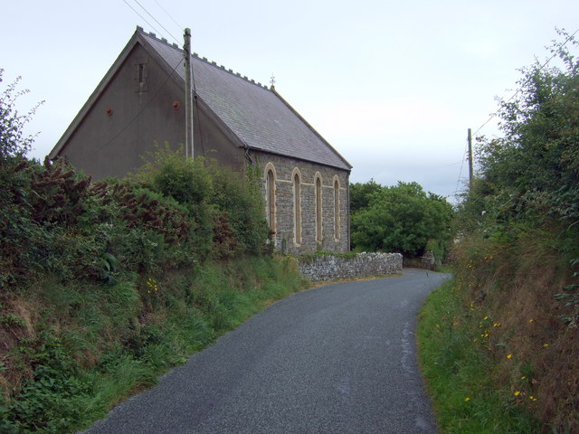
Image: © Natasha Ceridwen de Chroustchoff Taken: 18 Jul 2008
The roadside chapel of Cerizim (or Gerizim) as seen when approaching from the west. Built in 1848, it replaced an earlier chapel (Soar) a short way further along at the bridge.
Images are licensed for reuse under creativecommons.org/licenses/by-sa/2.0
Image Location


Leaflet Map data © OpenStreetMap
Latitude
52.097444
Longitude
-4.717587