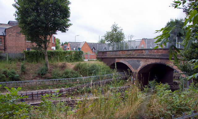
Stanley Road Footbridge
Introduction
The photograph on this page of Stanley Road Footbridge by Martin Addison as part of the Geograph project.
The Geograph project started in 2005 with the aim of publishing, organising and preserving representative images for every square kilometre of Great Britain, Ireland and the Isle of Man.
There are currently over 7.5m images from over 14,400 individuals and you can help contribute to the project by visiting https://www.geograph.org.uk

Image: © Martin Addison Taken: 17 Jul 2008
3rd bridge over the Northern Line after leaving East Finchley Station in a northbound train. Although the bridge was built wide enough to carry road traffic, Stanley Road on the east side of the line has never been more than a footpath, while on the west side it has become a suburban cul-de-sac. The brickwork of the bridge has decayed quite badly and has been replaced with blue engineering brick in a number of places. This shot was taken from the playground of Holy Trinity school and a small piece of the netting to stop balls getting onto the line has crept into the photo.

