Broadwaters Mill
Introduction
The photograph on this page of Broadwaters Mill by Martyn B as part of the Geograph project.
The Geograph project started in 2005 with the aim of publishing, organising and preserving representative images for every square kilometre of Great Britain, Ireland and the Isle of Man.

There are currently over 7.5m images from over 14,400 individuals and you can help contribute to the project by visiting https://www.geograph.org.uk
Broadwaters Mill
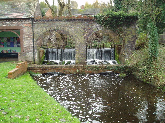
Image: © Martyn B Taken: 3 Dec 2005
Broadwaters Mill is situated immediately adjacent to the A449 trunk road, at the foot of the grid square. Picture taken from SO 84138 78036.
Images are licensed for reuse under creativecommons.org/licenses/by-sa/2.0
Image Location


Leaflet Map data © OpenStreetMap
Latitude
52.404286
Longitude
-2.229259