Former Cowdy's Mill, Banbridge (1981)
Introduction
The photograph on this page of Former Cowdy's Mill, Banbridge (1981) by Albert Bridge as part of the Geograph project.
The Geograph project started in 2005 with the aim of publishing, organising and preserving representative images for every square kilometre of Great Britain, Ireland and the Isle of Man.

There are currently over 7.5m images from over 14,400 individuals and you can help contribute to the project by visiting https://www.geograph.org.uk
Former Cowdy's Mill, Banbridge (1981)
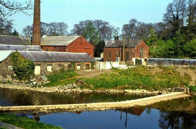
Image: © Albert Bridge Taken: 18 Apr 1981
When this photo was taken Cowdy’s had been closed for at least 15 years. It was being used for other commercial purposes but decay had already set in. See also Image
Images are licensed for reuse under creativecommons.org/licenses/by-sa/2.0
Image Location
Latitude
54.358109
Longitude
-6.277033