Long Lane
Introduction
The photograph on this page of Long Lane by Martin Addison as part of the Geograph project.
The Geograph project started in 2005 with the aim of publishing, organising and preserving representative images for every square kilometre of Great Britain, Ireland and the Isle of Man.

There are currently over 7.5m images from over 14,400 individuals and you can help contribute to the project by visiting https://www.geograph.org.uk
Long Lane
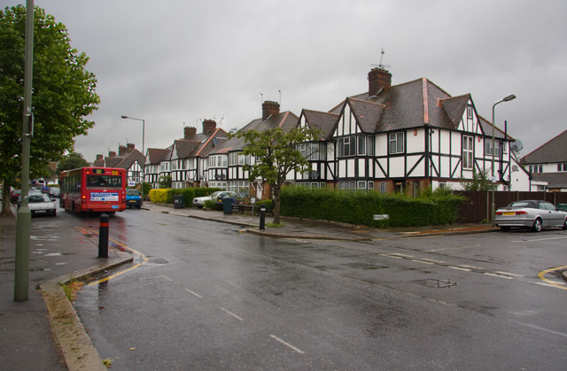
Image: © Martin Addison Taken: 7 Jul 2008
At the Finchley Central end of the lane are these examples of mock tudor housing. The road on the right is Parkside. A 382 bus disappears up the road on route to Mill Hill East.
Images are licensed for reuse under creativecommons.org/licenses/by-sa/2.0
Image Location
Latitude
51.603917
Longitude
-0.18692