Cabot House demolition
Introduction
The photograph on this page of Cabot House demolition by George Evans as part of the Geograph project.
The Geograph project started in 2005 with the aim of publishing, organising and preserving representative images for every square kilometre of Great Britain, Ireland and the Isle of Man.

There are currently over 7.5m images from over 14,400 individuals and you can help contribute to the project by visiting https://www.geograph.org.uk
Cabot House demolition
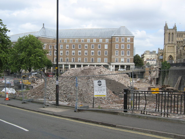
Image: © George Evans Taken: 28 Jun 2008
Looking over the demolition site of the derelict Cabot House towards the Council House and Cathedral (compare with the left of this photo: ST5872 : Looking along Deanery Road).
Images are licensed for reuse under creativecommons.org/licenses/by-sa/2.0
Image Location
Latitude
51.451819
Longitude
-2.603224