Tyttenhanger House
Introduction
The photograph on this page of Tyttenhanger House by Mike Hartley as part of the Geograph project.
The Geograph project started in 2005 with the aim of publishing, organising and preserving representative images for every square kilometre of Great Britain, Ireland and the Isle of Man.

There are currently over 7.5m images from over 14,400 individuals and you can help contribute to the project by visiting https://www.geograph.org.uk
Tyttenhanger House
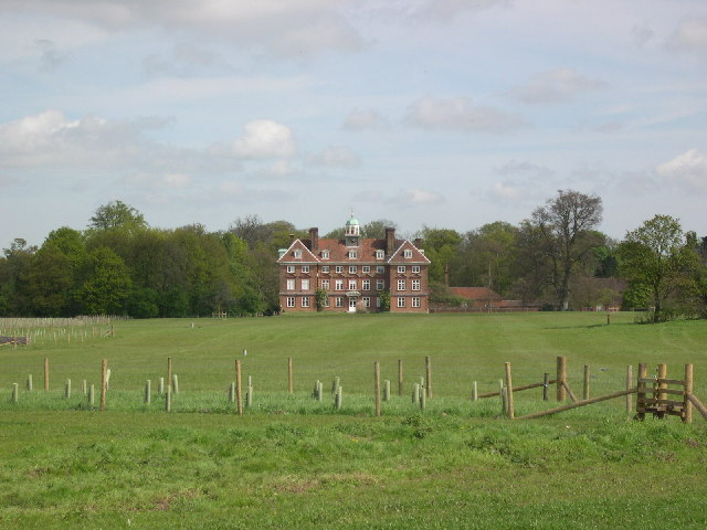
Image: © Mike Hartley Taken: 29 Apr 2005
This grade 1 listed building, now converted to offices, sits in Tyttenhanger Park, which occupied most of the square
Images are licensed for reuse under creativecommons.org/licenses/by-sa/2.0
Image Location


Leaflet Map data © OpenStreetMap
Latitude
51.726493
Longitude
-0.271215