Brockholes Methodist Church
Introduction
The photograph on this page of Brockholes Methodist Church by Humphrey Bolton as part of the Geograph project.
The Geograph project started in 2005 with the aim of publishing, organising and preserving representative images for every square kilometre of Great Britain, Ireland and the Isle of Man.

There are currently over 7.5m images from over 14,400 individuals and you can help contribute to the project by visiting https://www.geograph.org.uk
Brockholes Methodist Church
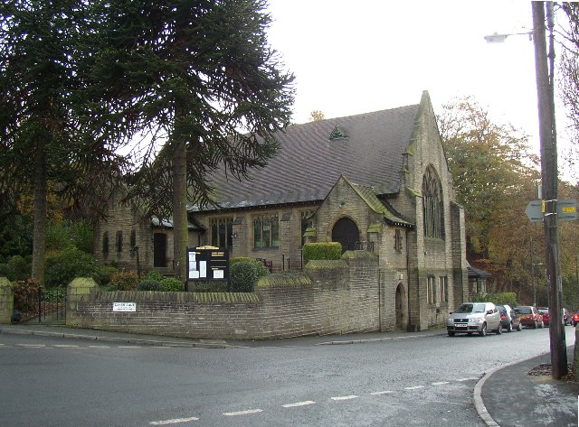
Image: © Humphrey Bolton Taken: 29 Nov 2005
Brockholes started as a hamlet in Thurstonland township, but merged with Smithy Place in Honley township grew into an industrial village with its own church, chapel and school. This chapel uses the Perpendicular style, but in a 19C way. Note the basement room with access from the road, using the fall of the land to advantage, and the fine pair of (Chilean?) pine trees.
Images are licensed for reuse under creativecommons.org/licenses/by-sa/2.0
Image Location


Leaflet Map data © OpenStreetMap
Latitude
53.593559
Longitude
-1.771825