Folgate Street, Spitalfields
Introduction
The photograph on this page of Folgate Street, Spitalfields by Stephen McKay as part of the Geograph project.
The Geograph project started in 2005 with the aim of publishing, organising and preserving representative images for every square kilometre of Great Britain, Ireland and the Isle of Man.

There are currently over 7.5m images from over 14,400 individuals and you can help contribute to the project by visiting https://www.geograph.org.uk
Folgate Street, Spitalfields
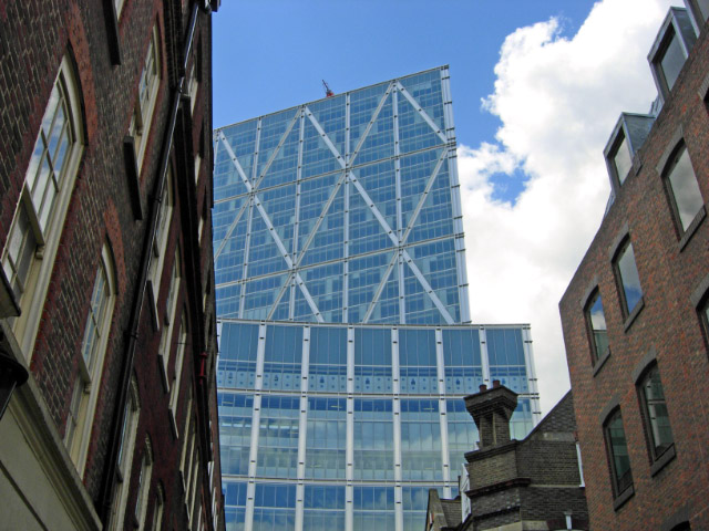
Image: © Stephen McKay Taken: 19 Jun 2008
18th century Huguenot weavers' houses line Folgate Street; they were saved from demolition by a concerted campaign in the 1960s. Overshadowing these are the ultra-modern Broadgate Tower and associated 201 Bishopsgate building. The 'A frame' structure of the tower is designed to provide structural strength; unlike conventionally-designed skyscrapers this building does not have a central core - necessary to distribute weight away from the raft across the railway out of Liverpool Street station on which it is built.
Images are licensed for reuse under creativecommons.org/licenses/by-sa/2.0
Image Location
Latitude
51.521066
Longitude
-0.077635