Potwell Dyke Grasslands
Introduction
The photograph on this page of Potwell Dyke Grasslands by Alan Murray-Rust as part of the Geograph project.
The Geograph project started in 2005 with the aim of publishing, organising and preserving representative images for every square kilometre of Great Britain, Ireland and the Isle of Man.

There are currently over 7.5m images from over 14,400 individuals and you can help contribute to the project by visiting https://www.geograph.org.uk
Potwell Dyke Grasslands
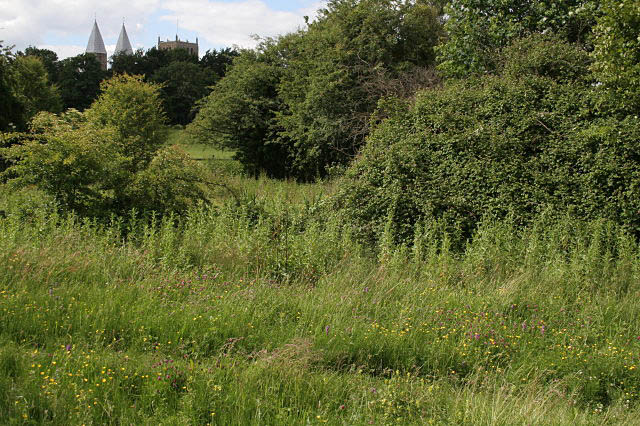
Image: © Alan Murray-Rust Taken: 19 Jun 2008
This is the lowest part of the site, close to the Potwell Dyke stream, and the damp soil supports a fine colony of Southern Marsh Orchid, a number of whose spikes can be seen in this picture, along with particularly clover and buttercup.
Images are licensed for reuse under creativecommons.org/licenses/by-sa/2.0
Image Location
Latitude
53.073837
Longitude
-0.951252