Lebanon, Cupar
Introduction
The photograph on this page of Lebanon, Cupar by Jim Bain as part of the Geograph project.
The Geograph project started in 2005 with the aim of publishing, organising and preserving representative images for every square kilometre of Great Britain, Ireland and the Isle of Man.

There are currently over 7.5m images from over 14,400 individuals and you can help contribute to the project by visiting https://www.geograph.org.uk
Lebanon, Cupar
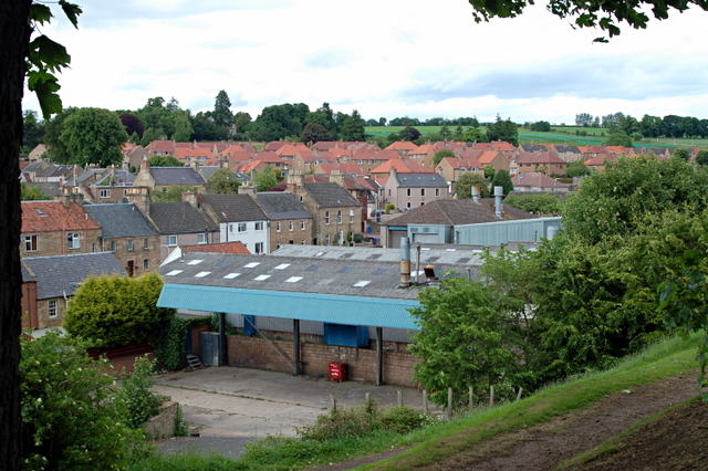
Image: © Jim Bain Taken: 12 Jun 2008
The last remains of a sawmill, Dye works and the town's gas works from Moat Hill. At the turn of the 1900s this area was one of two major industrial sites in Cupar. Both have now largely been replaced with retail and housing. At the turn of the 1900s this area was one of two major industrial sites in Cupar. Both have now largely been replaced with retail and housing and this last remnant in Lebanon seems to heading the same way with the relocation of Heggies to other premises in the town.
Images are licensed for reuse under creativecommons.org/licenses/by-sa/2.0
Image Location


Leaflet Map data © OpenStreetMap
Latitude
56.322048
Longitude
-3.016004