Dornie from Camuslongart
Introduction
The photograph on this page of Dornie from Camuslongart by Anne Burgess as part of the Geograph project.
The Geograph project started in 2005 with the aim of publishing, organising and preserving representative images for every square kilometre of Great Britain, Ireland and the Isle of Man.

There are currently over 7.5m images from over 14,400 individuals and you can help contribute to the project by visiting https://www.geograph.org.uk
Dornie from Camuslongart
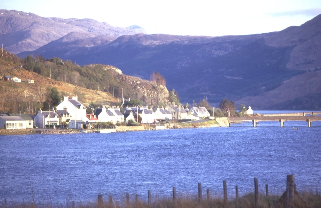
Image: © Anne Burgess Taken: Unknown
The nearer bridge in this view is the bridge between Dornie and Ardelve, which replaced the former ferry in 1940. It has now been replaced by another bridge, opened in 1990. The more distant bridge is the access to Eilean Donan Castle in Image
Images are licensed for reuse under creativecommons.org/licenses/by-sa/2.0
Image Location


Leaflet Map data © OpenStreetMap
Latitude
57.281344
Longitude
-5.514554