River Ash and Violets Lane, Furneux Pelham
Introduction
The photograph on this page of River Ash and Violets Lane, Furneux Pelham by Nigel Cox as part of the Geograph project.
The Geograph project started in 2005 with the aim of publishing, organising and preserving representative images for every square kilometre of Great Britain, Ireland and the Isle of Man.

There are currently over 7.5m images from over 14,400 individuals and you can help contribute to the project by visiting https://www.geograph.org.uk
River Ash and Violets Lane, Furneux Pelham
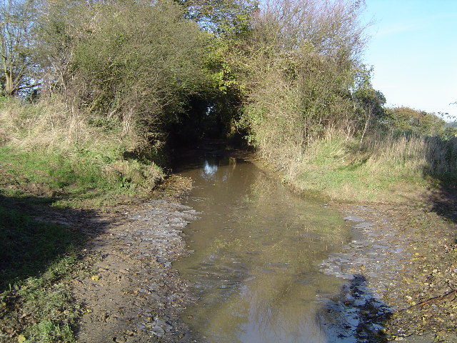
Image: © Nigel Cox Taken: 19 Nov 2005
This is a linear ford where the river and the road run together in the same space for about 1 kilometre, running into TL4329. The road is wisely described as being "Unsuitable for Motors". This is the downstream or southern end of the ford where the river goes off on the left into its own channel again. This view was taken looking northwards up the ford on a day when the ice had been broken by an agricultural vehicle.
Images are licensed for reuse under creativecommons.org/licenses/by-sa/2.0
Image Location


Leaflet Map data © OpenStreetMap
Latitude
51.934662
Longitude
0.088809