Coal from Cwm Bargoed
Introduction
The photograph on this page of Coal from Cwm Bargoed by roger geach as part of the Geograph project.
The Geograph project started in 2005 with the aim of publishing, organising and preserving representative images for every square kilometre of Great Britain, Ireland and the Isle of Man.

There are currently over 7.5m images from over 14,400 individuals and you can help contribute to the project by visiting https://www.geograph.org.uk
Coal from Cwm Bargoed
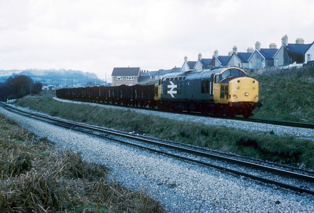
Image: © roger geach Taken: 9 Apr 1987
Approaching the Junction at Nelson and Llancaiach this train has come to a stand. The line in the foreground once went to Deep Navigation Mine and Trelewis. This was a busy location with the movement of coal and shale. Nowadays only the line to Cwm Bargoed is left with infrequent trains.
Images are licensed for reuse under creativecommons.org/licenses/by-sa/2.0
Image Location


Leaflet Map data © OpenStreetMap
Latitude
51.659818
Longitude
-3.291112