The Gateway, Dover
Introduction
The photograph on this page of The Gateway, Dover by Stephen McKay as part of the Geograph project.
The Geograph project started in 2005 with the aim of publishing, organising and preserving representative images for every square kilometre of Great Britain, Ireland and the Isle of Man.

There are currently over 7.5m images from over 14,400 individuals and you can help contribute to the project by visiting https://www.geograph.org.uk
The Gateway, Dover
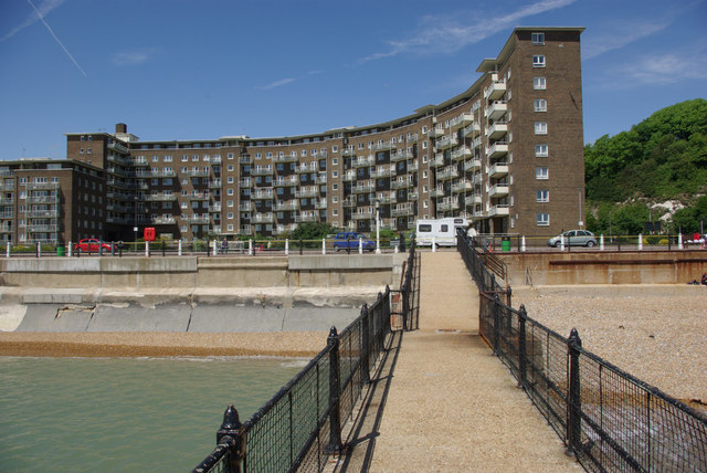
Image: © Stephen McKay Taken: 25 May 2008
The Gateway is the name given to this huge post-war development on Dover's seafront that replaced an area virtually obliterated by enemy action. This type of architecture is deeply unfashionable today, but these flats are arguably one of the better examples of the genre.
Images are licensed for reuse under creativecommons.org/licenses/by-sa/2.0
Image Location
Latitude
51.12492
Longitude
1.318817