Vane Tower
Introduction
The photograph on this page of Vane Tower by Derek Harper as part of the Geograph project.
The Geograph project started in 2005 with the aim of publishing, organising and preserving representative images for every square kilometre of Great Britain, Ireland and the Isle of Man.

There are currently over 7.5m images from over 14,400 individuals and you can help contribute to the project by visiting https://www.geograph.org.uk
Vane Tower
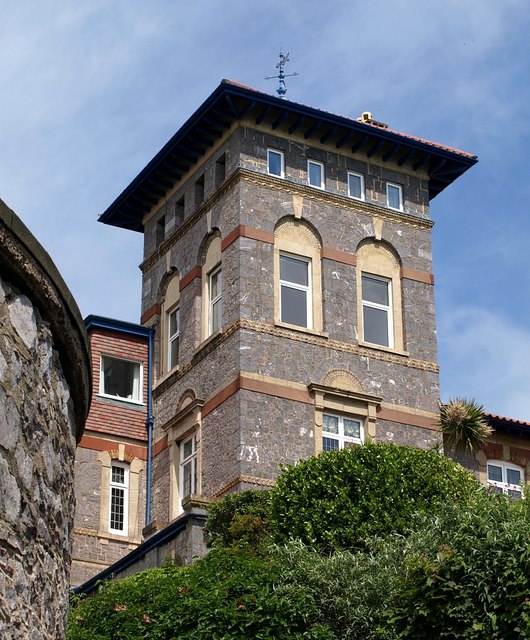
Image: © Derek Harper Taken: 25 May 2008
The tower of a now-subdivided Italianate villa on Vane Hill dating from 1871, seen from the top of the steps shown in Image https://historicengland.org.uk/listing/the-list/list-entry/1291576 : "The tower ... has a hipped slate roof with eaves brackets. Tower windows round-headed and arranged as pairs or singles."
Images are licensed for reuse under creativecommons.org/licenses/by-sa/2.0
Image Location
Latitude
50.459027
Longitude
-3.522144