Stedcombe House
Introduction
The photograph on this page of Stedcombe House by Katy Walters as part of the Geograph project.
The Geograph project started in 2005 with the aim of publishing, organising and preserving representative images for every square kilometre of Great Britain, Ireland and the Isle of Man.

There are currently over 7.5m images from over 14,400 individuals and you can help contribute to the project by visiting https://www.geograph.org.uk
Stedcombe House
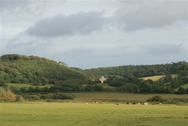
Image: © Katy Walters Taken: 19 Sep 2007
Seen from the Seaton Tramway (with a long-ish lens). It was built by Richard Hallett about 1697, in the latest William & Mary style, funded at least in part from the profits of the slave trade. The previous house was razed by Royalists during the Civil War. ( http://www.lymeregismuseum.co.uk/ethnic_Minorities_3.htm , http://www.bbc.co.uk/dorset/content/articles/2004/10/21/lyme_history_feature.shtml , http://www.thelocalchannel.co.uk/Axmouth/home.aspx ) The house fell vacant in the 1960s, became derelict by the 1970s, but was restored by 1992. ( http://www.rgspiller.co.uk/printfriendlyprojects.cfm?CFID=3398689&CFTOKEN=86470169&id=111 )
Images are licensed for reuse under creativecommons.org/licenses/by-sa/2.0
Image Location
Latitude
50.722591
Longitude
-3.043177